|
|||||
 |
|||||
| water is life | |||||
 |
All water used in Solano County comes from one of three sources: · groundwater · the Solano Project via the Putah South Canal · the State Water Project via the North Bay Aqueduct |
||||
|
groundwater
Below Solano County's lands lie two main groundwater basins. The larger basin, in the eastern portion of the county, is the Solano Subbasin. It is part of the Sacramento Valley Groundwater Basin. This basin underlies the cities of Vacaville, Dixon, and Rio Vista. The second basin is the Fairfield-Suisun Subbasin. It underlies those two cities, all of the areas that drain into Suisun Marsh, and the Marsh itself. The groundwater basins are geologic 'containers', and within the basins are aquifers, which are layers where water is stored. Wells pump water up out of the aquifer layers. The two main aquifers in Solano County are the Putah Fan and the Tehama Formation. The Putah Fan is a shallow aquifer, meaning that it is closer to the surface. It also is the most widely used groundwater source in the county. The Tehama Formation is a much deeper aquifer, and only comes near enough to the land surface to be accessed in the area north of Vacaville. The cities of Dixon and Rio Vista are the only cities in the county to exclusively use groundwater for their water supply, and they pump from the Putah Fan aquifer. The Dixon District (managed by Cal Water since the early 1900s) and Dixon's Municipal Water System both operate large production wells and storage tanks, oversee water quality, and provide water treatment. Rio Vista's water structure and delivery is managed by the city's Public Works department. Vacaville and the Solano Irrigation District also utilize the Putah Fan for some of their water. Only Vacaville and the Rural North Vacaville Water District use water pumped from the Tehama Formation aquifer. |
|||||
| In 2014, the state of California passed a law requiring the formation of groundwater sustainability agencies (GSAs) to develop, implement, and enforce groundwater sustainability plans. The plans provide a management guide for monitoring and improving conditions throughout the Sub-Basin. The Solano Subbasin GSA Collaborative is made up of six area GSAs, and their sustainability plan was approved in 2022. | |||||
 |
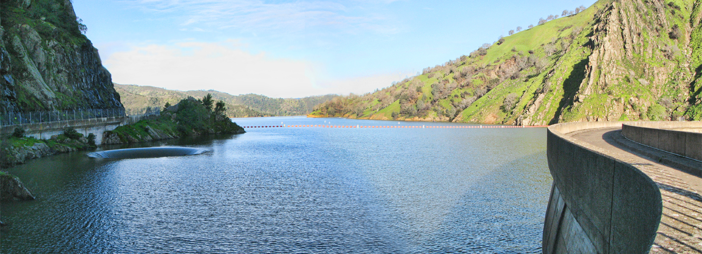
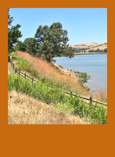
the Solano Project Since the 1880s, County leaders have understood how vital reliable water supplies are to agriculture. In the 1940s, the Solano Project was instituted to ensure that local agriculture would have the water they needed year-round, without overdrafting groundwater. In 1948, authorization was received from the Secretary of the Interior for the Solano Project to begin building Monticello Dam on Putah Creek. The Solano Project is independent of both the Central Valley Project and the State Water Project (SWP), California's two large irrigation operations. Monticello Dam itself is unique in the state of California, because up until now, all of the water has been used locally rather than conveyed to other locations. But there are pressures to change the current situation. Monticello Dam is the largest structure in the Solano Project, constructed 1953-1957, and its completion created Lake Berryessa, one of the largest man-made lakes in California. It has a storage capacity of about 1.6 million acre feet of water. Water flows out of the dam into Putah Creek, which forms the boundary between Solano and Yolo Counties. About 6 miles downstream, the next structure of the Solano Project is the Putah Diversion Dam. Here, much of the water is redirected into the Putah South Canal. The Diversion Dam also created Lake Solano. |
||||
 |
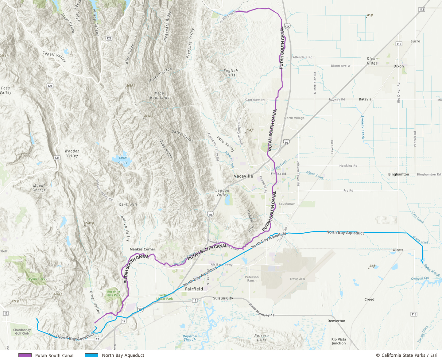
The Putah South
Canal is a little more than 30 miles in length, ending in the
Terminal Dam and Reservoir located in western Fairfield. The
water is delivered along the way for irrigation of farmlands, plus
municipal and industrial uses in Vacaville, Fairfield, Suisun,
Benicia, and Vallejo. Because the route is along the
foothills, most water taken from the canal is accomplished by
gravity, minimizing the need for pumping. Only water destined for
Vallejo must be pumped from the reservoir; however, in emergencies,
water can be pumped to other locations. What are the pressures on the Solano Project? First of all is the State of California's desire to require 65% of Lake Berryessa water to be released. Their idea is that the extra flows could be directed to the San Francisco Bay-Delta to relieve the Delta's shortfalls caused by over-pumping and diversion projects. This is classic example of a 'throwing good money after bad' scenario. Trying to solve Delta water problems by wreaking havoc with Solano County's water supply won't work. We'd only see the problems multiply and spread. The second issue that is impacting the Solano Project is new supply demands from the Flannery / California Forever development. The development as proposed is estimated to double Solano County's population, and although a specific analysis has not yet been conducted, it isn't hard to grasp that the additional water demands would be significant. Local water agencies have already gone on record stating that there is no available water for the proposed new homes. |
||||
 click image to enlarge |
|||||
 |
the North Bay Aqueduct The building of this underground pipeline marked the first time that California's State Water Project (SWP) became a water provider in Solano County. Phase I of the project, built in 1967-1968, supplied water to Benicia, Vallejo, and the Napa Terminal Reservoirs in eastern Napa County. Water from the Solano Project was used as an interim source during this initial phase. During Phase II (1985-1988), the California Department of Resources' (DWR) Barker Slough Pumping Plant was built. The pumping plant marks the current starting point of the aqueduct. Located in the California Delta, about 5 miles west of the Sacramento River Channel, the facility pumps about 120 acre feet of water per year into the aqueduct pipeline. About 9 miles west of the pumping station, the aqueduct reaches the Travis Surge Tank, located near Travis Air Force Base. The purpose of the tank is to control pressure surges caused by sudden changes in water flow. This prevents damage to the aqueduct pipes. Water destined for municipal and industrial use is next sent to the North Bay Regional Water Treatment Plant. This facility was a joint project of Fairfield and Vacaville, and it started operating in 1990. While owned jointly, the treatment plant is operated by the City of Fairfield. It has the capacity to process 40 million gallons of water per day and it also can treat water from the nearby Putah South Canal. Treated water can be sent from the plant to the cities and Fairfield's Travis Air Force Base. The next aqueduct facility is the Cordelia Forebay and Pumping Plant. The forebay is a small reservoir in western Fairfield, and the pumping plant sends water to Benicia, Vallejo, and to Napa County. From the Napa Terminal Reservoirs, water is directed to the cities of Napa and Calistoga, plus a small amount for irrigation to American Canyon. |
||||
 |
The North Bay
Aqueduct has issues also. Studies have shown for years that the
pipeline cannot deliver the contracted water amount of 175 cubic
feet per second. The DWR, Solano County Water Agency, and Napa
county have investigated possible solutions to the flow problem. Additionally, the aqueduct water has been rated as "the poorest drinking water quality in the State Water Project." Two main reasons for this are high organic carbon levels and high turbidity. Organic carbon reacts with chemicals used as water disinfectants, resulting in carcinogenic byproducts. High turbidity--meaning the water is cloudy rather than clear due to particulates in it--can be lessened, but by adding more chemicals. Both the carbon levels and high turbidity remain challenging problems.
In an attempt to
remedy the water quality situation, a proposal titled the 'North Bay
Aqueduct Alternate Intake Project' underwent a state-funded
feasibility study which was completed in 2020. The project calls for
a new pumping facility on the Sacramento River, south of West
Sacramento. This station would be a second source of water when
conditions at the Barker Slough facility are poor. |
||||
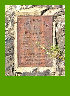 |
water roundup Of course, there are a couple of outliers to the 'three sources of water', and they are both from a bygone era. The City of Vallejo operates the Lakes Water System, serving fewer than 1000 customers in Green Valley, Gordon Valley, and the Old Cordelia area. The water originates in Lake Frey and Lake Madigan in Napa County, using a water system that dates back to the 1890s. Benicia's Lake Herman was formed by damming Sulphur Springs Creek back in 1905. Today the lake is used as a backup water source, and was put into emergency use in 2023 when the main pipeline to the city was broken during a mudslide. The bottom line: despite the wise planning of Solano County water managers, ample water for agriculture and residents is not guaranteed. The rights to all of the water currently available have been allocated. This means that there is no available water for most new development. In addition, our region has been subject to multiple droughts, and along with most of California, we're experiencing more frequent effects of climate change. |
||||
 |
|||||
| TOP | |||||
| © 2026 Solano Orderly Growth Committee | |||||